


Legal persons: Te Urewera, Te Awa Tupua, Taranaki Mounga
On Thursday 30 January 2025, Taranaki Maunga was officially granted legal personhood under New Zealand law. It became the third geographical feature in Aotearoa to receive this status, following Te Urewera in 2014 and Te Whanganui Awa (the Whanganui River) in 2017.
What Does “Legal Personhood” Mean?
Granting legal personhood to a natural feature is a legal framework that recognises nature as having intrinsic rights and interests, independent of human ownership or utility. Rather than treating land or water as property, this approach acknowledges nature as an entity with its own standing.
In Aotearoa New Zealand, the recognition of legal personhood for Te Urewera, Te Awa Tupua, and Taranaki Maunga reflects the deep spiritual, cultural, and genealogical relationships that Māori have with these places. These relationships are central to Māori identity and worldview.
Beyond symbolism, legal personhood has practical effects:
- Rights and interests: as legal persons, these natural features have rights that must be recognised and protected
- Conservation and management: personhood supports more holistic and enduring approaches to environmental stewardship
- Decision-making: the interests of the land or river must be represented in legal and policy decisions
International Context
Similar approaches have been adopted internationally. In 2018, the Uttarakhand High Court in India granted legal personhood to the Ganges and Yamuna rivers, recognising their ecological and cultural significance.
Te Urewera
Te Urewera is a rugged hill country between the Bay of Plenty and Hawke’s Bay. It is the ancestral homeland of Tūhoe, often referred to as Ngā Tamariki o te Kohu — the children of the mist.
Known for its vast indigenous forests, Te Urewera National Park was established in 1954. The Lake Waikaremoana track, named “te moana e rīripā ana” (the sea of rippling waters), has long been a popular multi-day walk.
The Te Urewera Act 2014 declared Te Urewera a legal entity, possessing all the rights, powers, duties, and liabilities of a legal person. The Act disestablished Te Urewera National Park and established the Te Urewera Board, comprising joint Tūhoe and Crown representation.
This governance model gave legal effect to the Ngāi Tūhoe Treaty of Waitangi Settlement.
Te Whanganui Awa (Te Awa Tupua)
The Whanganui River is Aotearoa’s third-longest river, navigable for approximately 230 kilometres from its headwaters in the central North Island to the Tasman Sea. Historically, around 80 pā and villages were established along its banks, and the river served as a major transport and trade route.
Today, the journey between Taumarunui and Pipiriki is a well-known river experience. The river was also featured in the 2005 film The River Queen.
Iwi connected to the river include Te Āti Haunui-a-Pāpārangi, Ngāti Hāua, Ngāti Hauiti, Ngāti Rangi, and Tamahaki. Their relationship with the river is captured in the whakataukī: “Ko au te awa. Ko te awa ko au.” — I am the river, and the river is me.
The Ruruku Whakatupua Deed of Settlement was signed in August 2014. This settlement established a legal framework recognising the river as a legal person and provided financial redress of approximately $115 million, including funding dedicated to the health and wellbeing of Te Awa Tupua.
In March 2017, the Te Awa Tupua Act 2017 formally conferred legal personhood on the river.
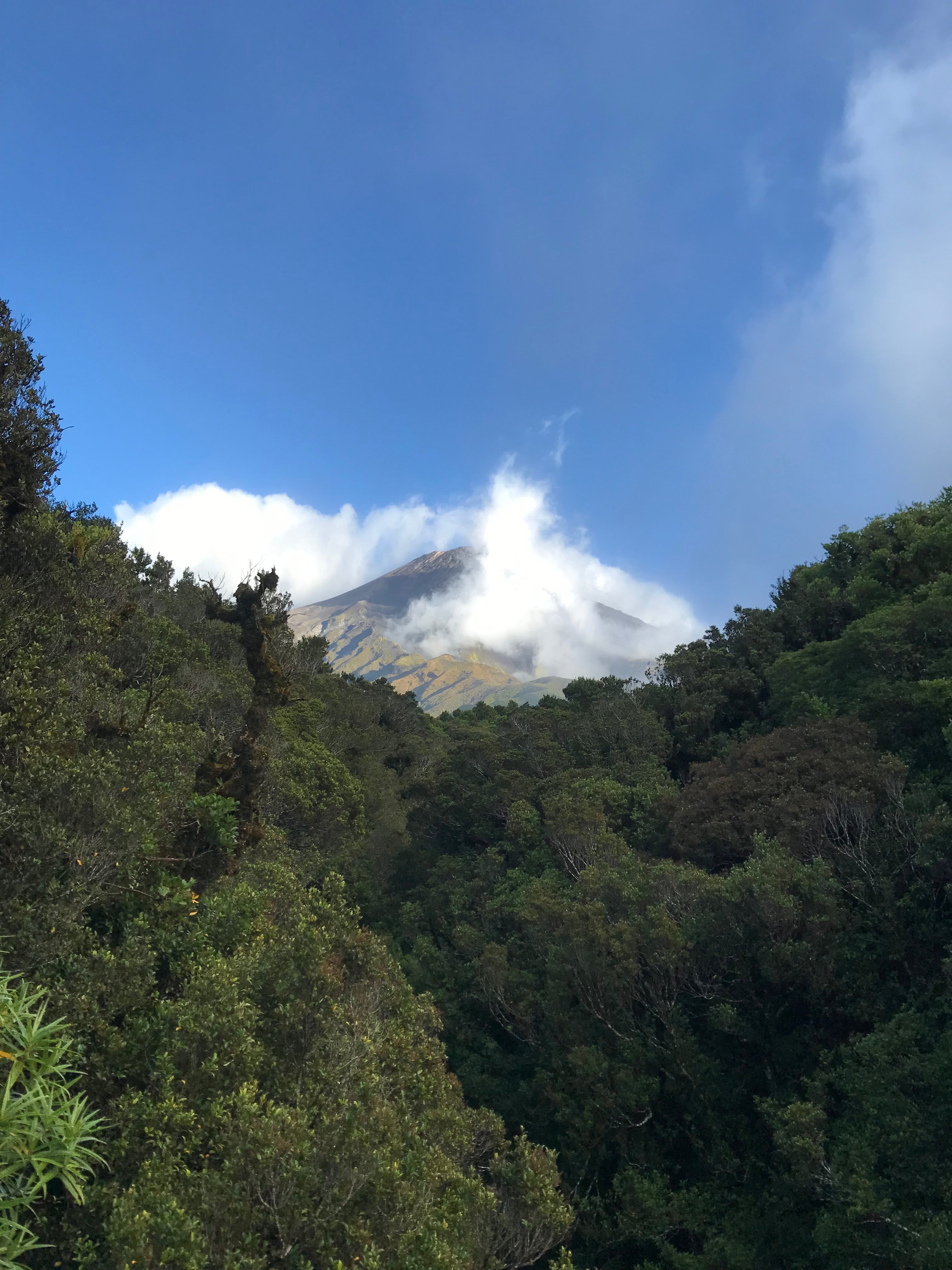
Taranaki Maunga
Taranaki Maunga (with mounga as the locally preferred spelling of maunga) is a strikingly symmetrical volcanic cone on the west coast of the North Island. It rises above the Taranaki plains to the east and the Tasman Sea to the west.
It is the second-highest mountain in the North Island after Ruapehu, which can be seen from Taranaki on clear days, over 100 kilometres away.
The new law confers legal personhood on Taranaki Maunga, its companion peaks, and surrounding environment, collectively named Te Kāhui Tupua. The colonial name Mount Egmont is being formally retired.
This legislation completes the implementation of the 2016 Treaty Settlement for Taranaki iwi. The settlement included a formal Crown apology for actions taken during the 19th-century Taranaki Wars, including land confiscations that severed iwi from culturally and economically vital landscapes.
The apology acknowledged the long-lasting and destructive effects of those confiscations on Taranaki iwi and their relationship with the maunga.